Terms like "off the charts" and "record breaking" are being used to describe the coming "super" El Niño that is taking shape in the Pacific.
Nothing is for certain when it comes to these predictions, but the forecast models are reportedly lining up and showing meteorologists a dramatic picture of what could be a record-busting El Niño season that will put the super El Niños of 1997-98 and 2015-16 to shame, not to mention 2022-23 which wasn't even that "super."
As the Chronicle weather team tells us today, and as they have been saying for a couple of months, temperatures below the surface in parts of the Pacific Ocean are currently 7 percent above normal in some places, which is "more heat at this stage of an El Niño’s development than has been observed in the modern record."
And atmospheric scientist Paul Roundy, who is based at the State University of New York at Albany, tells the paper that "a strong El Niño event [is] a virtual certainty," at this point, and he has it officially forecast as a 50 percent chance of being the strongest El Niño in 140 years.
What does this mean for Northern California? Well, the strongest El Niños on record here, in the winters of 1982-83 and 1997-98, meant we saw double the usual amount of rainfall here, and Australia meanwhile saw more extreme heat and drought during their summer.
The intensity of the warming that is going on in the Pacific could shift the direction of storms as well
A super El Niño was also predicted for the winter of 2023-24, and while that winter was indeed wet in the Bay Area, it was nothing compared to 1997-98, showing the variability in these events. That was the season of Hurricane Hilary, however, which hit in August 2023 and primarily affected Southern California and the Desert Southwest.
Warming surface temperatures in the Pacific could make for late summer or fall cyclones like that, as well.
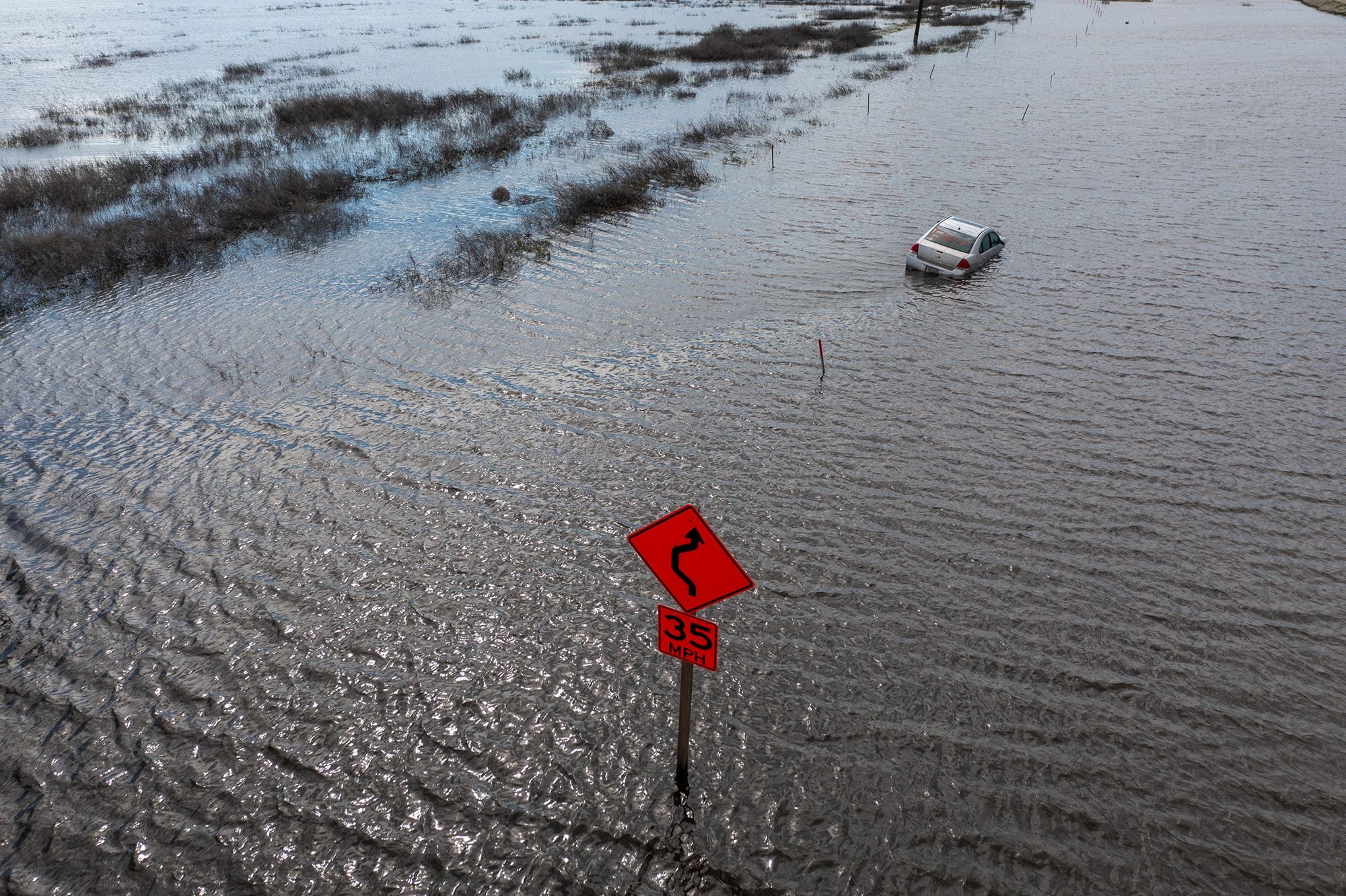
The doomsday scenario would be rains on the level of the winter of 1861-62, considered a 200-year flood event which happened 165 years ago. During that winter, back-to-back storms created inland lakes in California's Central Valley, flooding the new state capital of Sacramento — meaning that the capital temporarily moved to San Francisco — and causing catastrophic damage.
Tulare Lake, which emerged in the winter of 1861-62, re-emerged during the last El Nino season, in February/March 2023, with experts suggesting that this could happen again in wet seasons to come.
Will we see a replay of that, but worse, this fall and winter? We'll see!
At the very least, you may want to stock up early on sandbags if you have a below-grade garage, or any flood-prone areas.