Predicted Diablo winds between Monday night and Wednesday morning failed to materialize in most parts of the Bay, however a second wind event is forecast to begin Wednesday night and into Thursday morning.
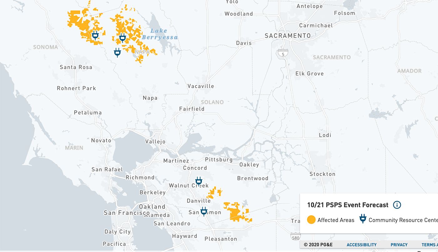
PG&E has shrunk its originally planned geography for tonight's public-safety power shutoff (PSPS), informing some North Bay customers that changing weather conditions have negated the need for the power to go off. Still, a number of areas of northern Napa county and east Santa Rosa are still being warned of a PSPS in the next 12 hours, along with isolated parts of the East Bay around Mount Diablo and south of it, as well as the hills east of San Jose.
The National Weather Service reports that Mount Diablo was seeing some of the highest winds as of this morning.
Shutoffs are already underway in other pockets of the region, and below the National Weather Service's Brian Garcia discusses the Red Flag Warnings that take effect starting at 10 p.m. on Wednesday and 1 a.m. Thursday.
Northeast Napa County, in the area of the Glass Fire and LNU Lightning Complex fires, is expected to see the highest winds in the coming 48 hours, and the Mount Diablo area as well.
Gusty offshore winds are still expected to hit multiple high-elevation parts of the Bay Area late tonight and Thursday night, with the possibility of gusts up to 40 miles per hour or more.
If you're wondering if you're going to lose power and haven't received an alert, check your address here.
But let's hope that the threat passes as it did earlier this week without too much drama. The fire- and power-shutoff-weary North Bay especially could use a break.
Also, some rain would be nice at some point.