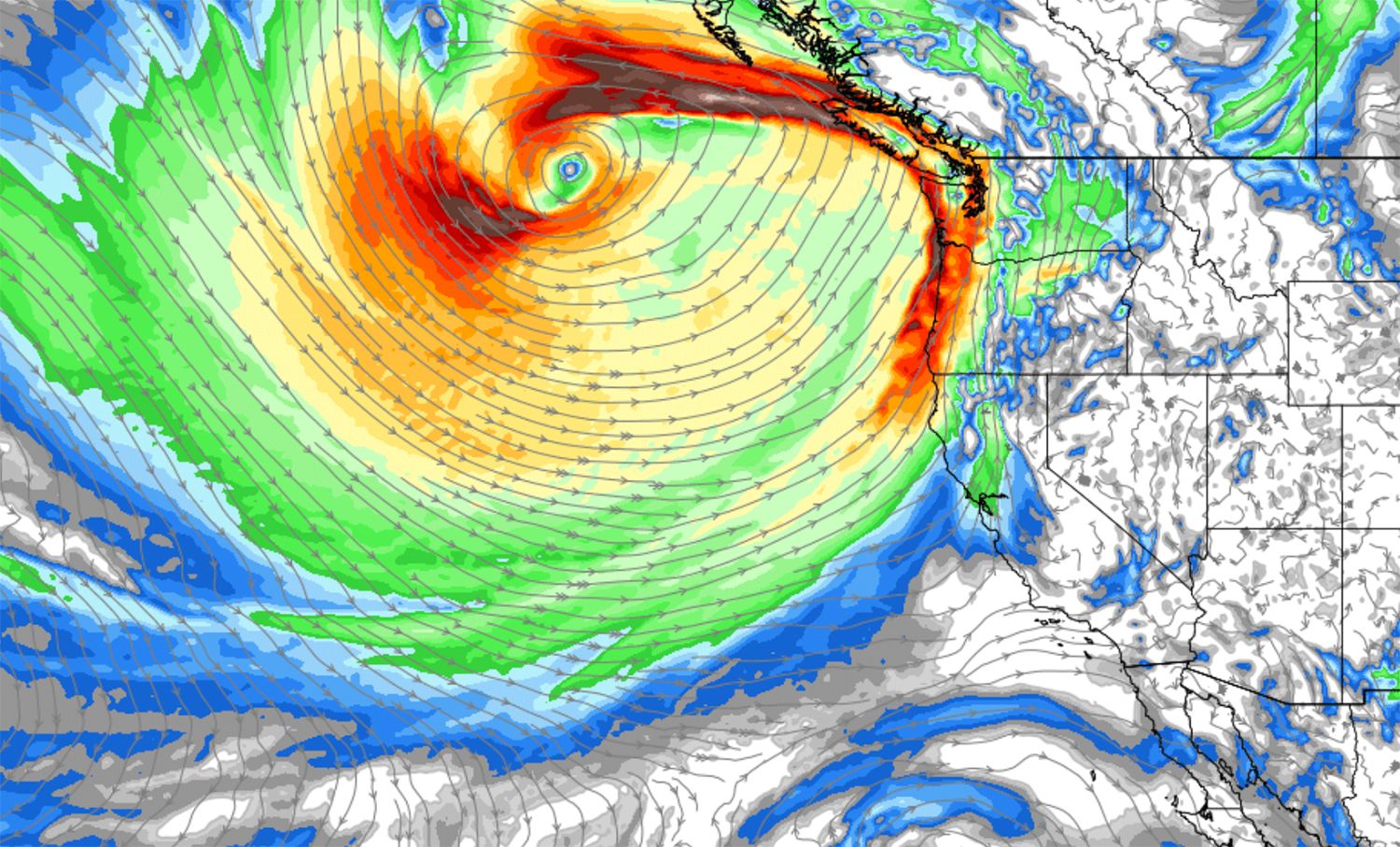
Today's clear and sunny weather in San Francisco, with — despite some lingering smoke in the air — some balmy afternoon highs close to 70 in some parts of town, will be repeated by mid-week next week, in even warmer fashion. But first, a storm's a-comin'.
Yes, the season's first atmospheric river is forming over the Pacific and is going to bring a wet Sunday night and Monday to the Pacific Northwest, Alaska, and western Canada. Parts of the North Bay may see some rainfall out of this as well, but the picture for SF is less clear — with the Apple Weather app just showing Monday and Tuesday as cloudy, for now.
The Chronicle forecasts a half-inch of rain around Santa Rosa and Healdsburg on Monday, but perhaps nothing south of there except some wind. The San Francisco Peninsula appears to fall just outside of the outermost band of the storm.
An unusual atmospheric river-fueled storm is headed to California. Here's what to expect:https://t.co/3fvuaQkcMX
— San Francisco Chronicle (@sfchronicle) September 21, 2023

This could, of course, change, but for now, SF is looking to stay dry and then see some Actual Summer arrive next week and hopefully linger a while.
The good news is that for much of Northern California and Oregon, from Redding all the way to Seattle, this bomb cyclone could spell an early end for fire season — with some spots getting multiple inches of rain in a short span. That should also do wonders for the still smoldering lightning complex fires that have been burning for over a month in NorCal and southern Oregon which have been mucking up our air quality this week.
But just the fact that such a storm is forming so early in the season doesn't exactly portend well for a calm winter — and, as we know, an El Niño winter is on the way. It's literally just the first day of fall on Saturday.
Last fall, the Bay Area saw its first bout of rain in early November, with the first atmospheric river hitting us in early December. In October 2021, though, a major, record-breaking bomb cyclone hit the region the week before Halloween, prompting lots of flooding all over.
Could this winter possibly be as wet as the last one? We'll see.

