This storm system has been no joke, and while much of the Bay Area saw significant rainfall in the last 24 hours, many spots that don't usually see snow accumulation saw plenty between Thursday and Friday, leading to some surprises on local roads.
Meteorologists familiar with the Bay and its microclimates aren't generally accustomed to predicting snowfall accumulations outside of the Sierra. And while most winters typically see some light snows on Mount St. Helena, Mount Diablo, and Mount Hamilton, snow on the ground in Healdsburg, Santa Rosa, and Oakland is a good bit less common.
As National Weather Service (NWS) meteorologist Brooke Bingaman tells NBC Bay Area, "This is a very rare event. It’s like Mother Nature has thrown us a jigsaw puzzle that we don’t often get to put together."
Areas around northern Sonoma and Napa counties saw between 2 and 3 inches of snowfall on Thursday night, and this led to a traffic snarl on typically quiet back road, Calistoga Grade (Petrified Forest Rd.). The connector between Santa Rosa and Calistoga became slippery, leading to an ambulance landing in a ditch and snowplow getting stuck, which in turn led to a 25-car backup on the road, as photojournalist Kent Porter documented on Twitter.
The Calistoga grade just west of Calistoga on Petrified Forest Rd. In Napa Co., is completely blocked with motorists, the result of an ambulance in a ditch, and a stuck plow. About 2-3” of snow. Elevation 400’. @NorthBayNews @NWSBayArea #CAwx pic.twitter.com/CHklNFWGIJ
— Kent Porter (@kentphotos) February 24, 2023
Samir Malik of Santa Rosa waits out a 25 vehicle backup from a traffic mishap on the Calistoga Grade (Petrified Forest Rd.) in Napa Co. Thurs., Feb. 23, 2023. Malik was attempting to get to his overnight job at the Four Seasons Resort in Calistoga. @NorthBayNews @NWSBayArea #CAwx pic.twitter.com/K9EC0j9U37
— Kent Porter (@kentphotos) February 24, 2023
Cloverdale saw significant accumulations of snow well below 1000 feet of elevation, as the NWS reported, with as much as 4 inches on the ground. As a result, all schools are closed in the Cloverdale Unified School District today.
Before the sun set on Thursday, people posted photos of snow on the ground in Healdsburg, on Skyline Boulevard in San Mateo County, and in the Oakland hills — all elevations that typically don't see snow.
Skyline Blvd just south of 92 pic.twitter.com/2MpUjkDxlm
— ThoreauBro (@ThoreauBro) February 23, 2023
Fat snowflakes flying in the Oakland Hills pic.twitter.com/kuwQUyJplv
— Drew Tuma (@DrewTumaABC7) February 23, 2023
The effects of the storm shut down Highway 17 in the Santa Cruz Mountains early Friday, due to heavy snowfall and downed trees.
🚧 Heads up!! 🚧
— NWS Bay Area 🌉 (@NWSBayArea) February 24, 2023
Hwy 17 is currently closed in both directions from Granite Creek Rd @ Scotts Valley to Bear Creek Rd. Here's what it looks like this morning near Redwood Estates. Reports of multiple trees down.#CAwx pic.twitter.com/MUfrFiYSSB
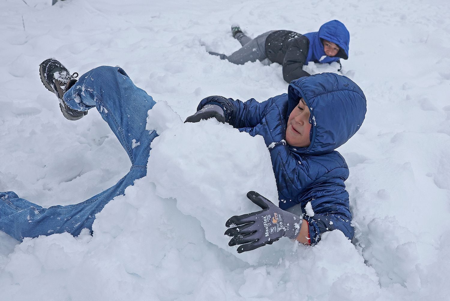
A Getty Images photographer captured some kids playing in the snow in Angwin, in Napa County, Friday morning.
Snowfall accumulation totals are still being collected, and the NWS put out a call on Twitter Friday morning for reports specifically from Calistoga and St. Helena.
As the Press Democrat reports, via the NWS, it's been 12 years since Sonoma County has seen any snowfall below 1000 feet, and the local weather service office doesn't track or keep snowfall totals.
San Francisco, meanwhile, saw heavy rain for much of Thursday night into Friday morning. This led to a ramp closure off 101 north in SoMa, where the Department of Public Works shut down the connector to Octavia Boulevard, apparently due to pooling water.
Thunder and bright lightning also came to SF, with least one documented lightning strike to the Transamerica Pyramid around 11:30 p.m.
lighting hitting the transamerica in SF. weather nerd badge unlocked @DrewTumaABC7 pic.twitter.com/s8oBmb3vQt
— Casey Wade (@CaseWade) February 24, 2023
This is the second time this winter that a storm system has brought rare lightning to SF, the first being back on January 10.
Top image: A sign for a vineyard is seen covered in snow on February 24, 2023 in Angwin, California. A large winter storm brought snow to lower elevations overnight in the Napa Valley. Much of California is being impacted by a cold winter storm that is bringing rain, wind a snow below 1,500 feet in many locations. (Photo by Justin Sullivan/Getty Images)