Local meteorologists are getting very jazzed about this rare September rain system coming our way, thanks to Typhoon Merbok, and this won't be any mere sprinkling.
The National Weather Service now has some rainfall total predictions for the Bay Area by Monday/Tuesday, and it's looking like this typhoon is going to bring a decent amount of wetness to fill our local creeks and dampen fire-prone hillsides.
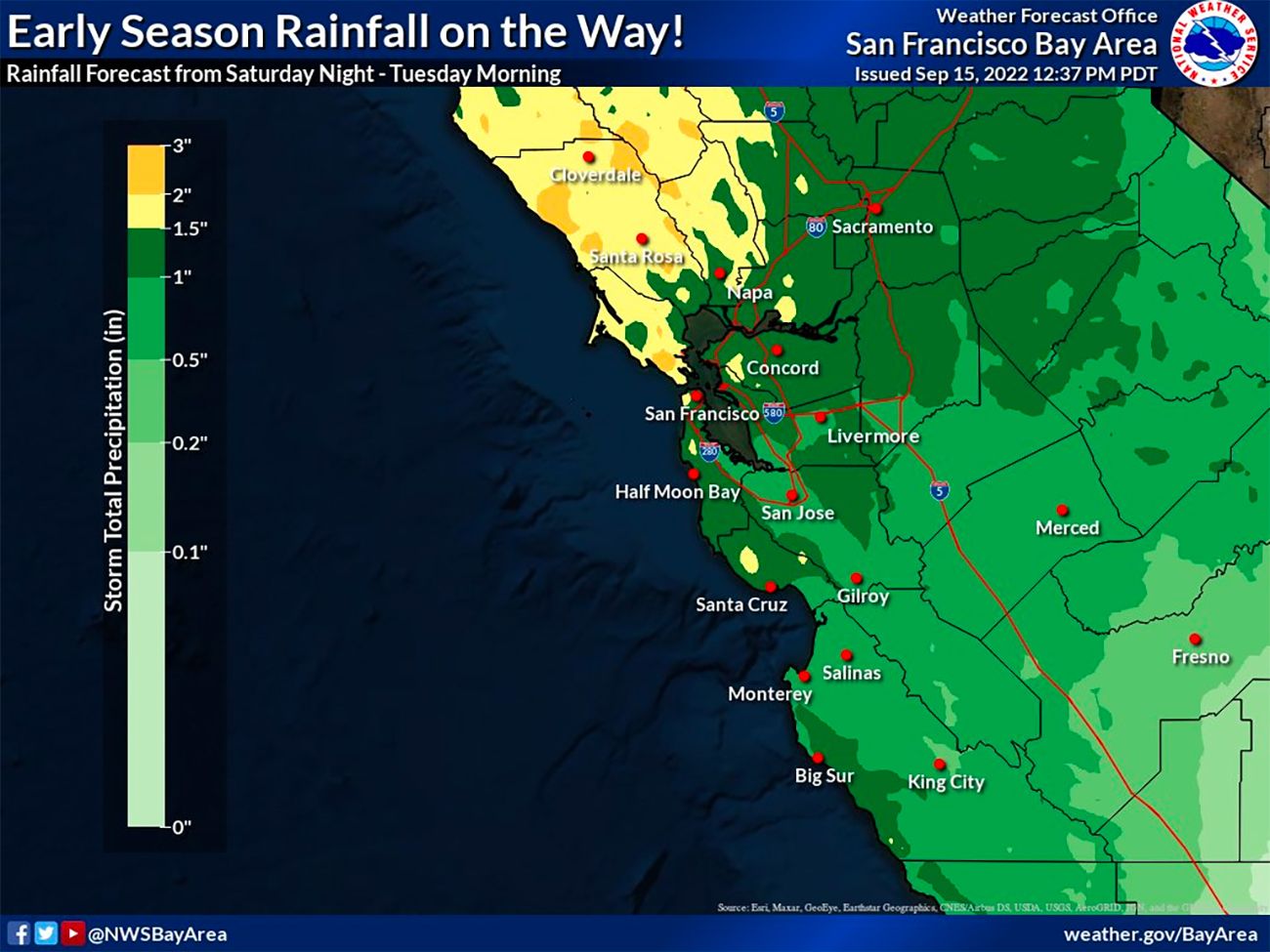
The forecast map has much of the North Bay getting drenched with two to three inches of rain, with the higher totals on mountaintops and along the Sonoma coast. You'll see on the map below that there's an area of yellow covering part of western San Francisco as well, which would mean up to two inches of rainfall in the city.
Speaking of excited meteorologists, National Weather Service meteorologist Brian Garcia made the explainer video below showing how the typhoon system will move into western Alaska and down over California in the next 24 to 48 hours. It's going to arrive first as a windy Saturday, with rain beginning Saturday night to our north and then likely peaking sometime on Sunday.
The wind gusts, as the Chronicle's Gerry Diaz tells us, could be between 15 and 25 miles per hour through much of Saturday.
And by Monday, the system might mean some snowfall in the Sierra, but that's uncertain, Diaz says. "Depending on how many of these rain showers survive their journey from the cold front to the Sierra front, some of them may evolve into snow showers come Monday night into Tuesday morning," Diaz writes.
California cold fronts? To quote Rachel Bloom: It's a little more nuanced than that. 💃🏽🪩
— Gerry Díaz (@geravitywave) September 15, 2022
Animation shows just how rugged this upcoming storm's cold front becomes once it interacts with our coastal ranges.
Despite those obstacles, we'll see it charge in this weekend. #CaWx pic.twitter.com/gIvshLB3sU
In the National Weather Service video above, toward the end, you'll see that meteorologist Brian Garcia discusses an area of high pressure that will take shape later next week, which will likely mean a return of warm weather, sunshine, and our typical late-September summertime heat.