It should come as a shock to no one that there exists no single, official, definitive map that delineates where the Inner Sunset begins and ends, or where the line is drawn between The Mission and Potrero Hill — though many of us have our own ideas. And, it turns out, depending on which department in SF City Hall you ask, you may get a different answer.
The Chronicle published one of its special projects today on this topic, noting the differences between what the Planning Department says are a neighborhood's boundaries, and what the Department of Elections says.
The Chronicle analyzed boundaries from three city agency maps to measure the uniformity of each San Francisco neighborhood. Here's what we found. https://t.co/zd90utud8p
— San Francisco Chronicle (@sfchronicle) February 24, 2022
Depending on whose map you consult, Chinatown is either a tight 24 blocks bounded by Kearny and Powell Streets, and starting at the south from Sutter where the Dragon's Gate is located at Grant (that's Planning's map for neighborhood notifications); or it's a much larger area that includes much of Columbus Avenue and extends west all the way down Broadway to Polk Street (that's the Dept. of Elections map).
The Elections map doesn't even consider North Beach as its own neighborhood — the area closer to the water surrounding Chinatown and the Financial District is just called "N. Embarcadero."
Similarly, the Elections map erases the Castro and Duboce Triangle — they're both subsumed in a larger "Upper Market/Eureka" neighborhood. And according to the Department of Elections, there is no Hayes Valley either — you're either in Civic Center or you're in the Western Addition, no in between.
The 311 neighborhoods map gets more micro, delineating all of the above along with other smaller 'hoods like Corona Heights and Mint Hill.
As the Chronicle explains, three city departments — the Department of Public Health, the Mayor's Office of Housing and Community Department, and the Planning Department — got together in 2014 to create a unified Analysis Neighborhoods Map, which has its own set of boundaries based on 2010 Census tracts. That map came about because city officials realized how many different maps were being used by different departments, which could easily throw off reporting for anything from COVID cases to housing needs if there wasn't a single map. That map looks the most like what most of us think contemporary neighborhood names and boundaries are — though there's sure to still be arguments. This map also doesn't include Dogpatch as its own thing, and as the Chronicle notes, Bayview/Hunters Point could get subdivided based on a big increase in population found in the 2020 Census.
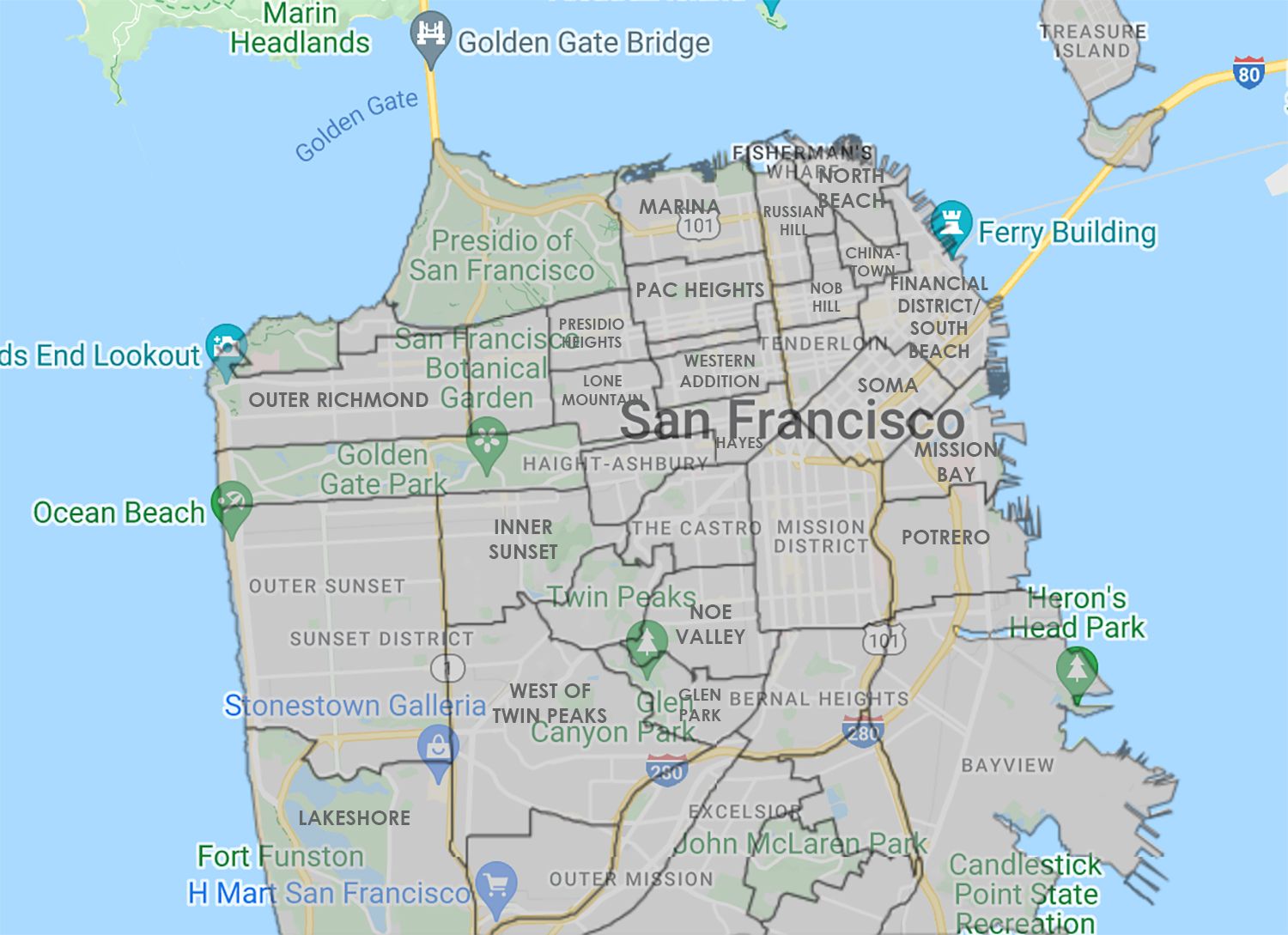
Some residents of what they'd call NoPa might be surprised to learn that in the city's view, they either live on Lone Mountain or in Hayes Valley. But this map at least conforms mostly to what SFist knows the larger neighborhood definitions to be — and no map can be considered reliable if it doesn't call The Castro The Castro.
In any event, you'd better get this stuff straight if you're going to write anything about this city, or the people will come for you on Twitter/in the comments and tell you you don't know jack shit about anything if you're calling Mariposa and Hampshire Potrero Hill.
It's good to know that city departments can't keep it straight either.