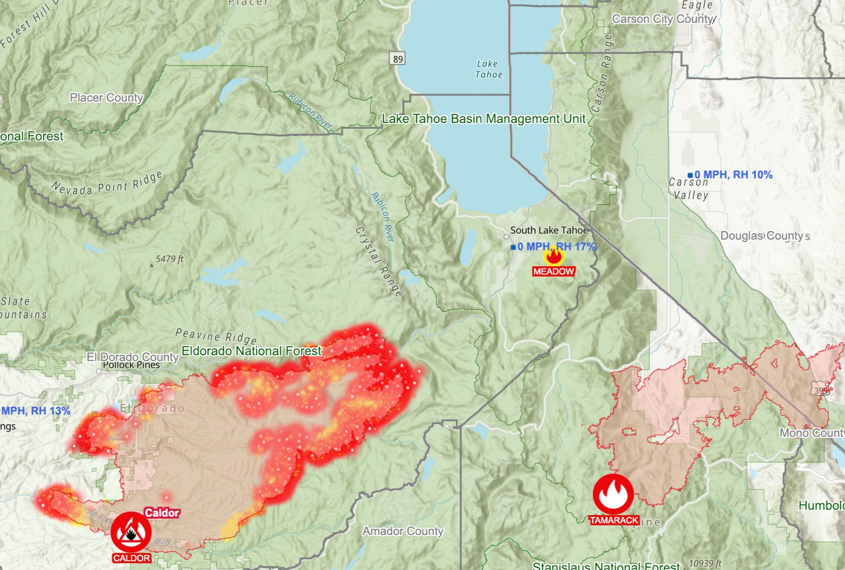
An evacuation warning has come to part of the Tahoe Basin, in the first time since 2007 that a wildfire has threatened the area — though firefighters continue to say that they will try to prevent any flames from entering the basin.
Evacuation orders extended Thursday to Echo Summit, and the area between Twin Bridges and the summit, and an evacuation warning was given to Christmas Valley, which sits beneath Echo Summit in the Tahoe Basin. As the Chronicle reports, the Caldor Fire continues burning east along Highway 50, and has now scorched 136,643 acres.
Wildfire smoke and oppressively bad air quality has plagued the Tahoe Basin for days now, and those conditions extend into Reno, where the Washoe County School District has had several schools closed due to air conditions.
As NPR reported this week, the last major wildfire to come to the basin was the Angora Fire in 2007, which exploded from a campfire and destroyed 254 homes in South Lake Tahoe. That fire brought an evacuation order for 2,000 residents in the area.
And adding to the blanket of smoke over much of Northern California are two new fires that broke out Wednesday: The Airola Fire in Calavares County, which is burning near New Melones Reservoir, had grown to 700 acres as Thursday morning; and the Bennett Fire was at nearly 60 acres in Grass Valley. A small fire named the Meadow Fire broke out in South Lake Tahoe on Wednesday as well.
Tahoe City in the north part of the basin and South Lake Tahoe had two of the nation's worst air quality ratings on Wednesday, registering in the mid-300s.
California's state fire chief Thom Porter warned earlier this week that the Caldor Fire was "knocking on the door" of the Tahoe Basin. But Cal Fire spokesperson Dave Lauchner said Thursday that the agency "still foresee[s] getting this stopped before the basin." He said the latest evacuation orders and warnings were because, "We just need to make sure anyone in the forest or in their homes still gets out."
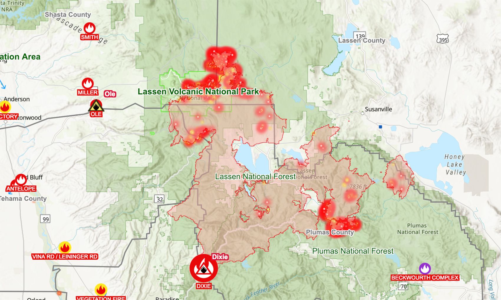
Meanwhile, the Dixie Fire, which has burned 747,091 acres across five counties, continues to be only 45% contained, six weeks after it began. Its hottest spots are currently in Lassen Volcanic National Park on the north front of the fire, and near Grizzly Mountain on the southeast flank of the fire.