The California Geological Survey (CGS) has released updated tsunami hazard area maps for the Bay Area, using worst-case scenario predictions to look at where residents will need to evacuate to higher ground.
Taking Japan's tsunami preparedness into account, and the cautionary tale of the April 2011 tsunami there and the Fukushima disaster, the CGS has created new hazard maps with the most conservative approach possible — replacing maps previously created in 2009. The new worst-case scenario would stem from a 9.3M earthquake in the eastern Aleutian Islands.
"Japan utilized data from several hundred years of tsunami records in its planning, which seemed perfectly reasonable," said Acting State Geologist and head of the CGS, Dr. Steve Bohlen. "Then it was impacted by a once-a-millennium tsunami. So, we’re taking a very conservative approach and using a thousand-year scenario as the baseline for our new maps, hoping to avoid the tragic loss of life experienced in Japan."
The new maps don't show significantly new hazards on the west side of San Francisco — save for the area around the zoo. Ocean Beach and parts of the Presidio would be impacted by a major tsunami, but most residential areas would be in safe zones.
The CGS notes, however, "The most significant increases in the mapped tsunami hazard area are in and around North Beach and downtown around Market Street."

"These are both areas with very low land elevations that could be impacted by a small increase in waterfront flooding," they add, also noting the side benefit of tsunami preparation vis a vis future sea level rise. "The new Tsunami Hazard Area maps around Market Street look similar to predicted flooding from long-term sea-level rise, so any waterfront flood prevention measures in that area may help reduce the risk from both tsunamis and climate change."
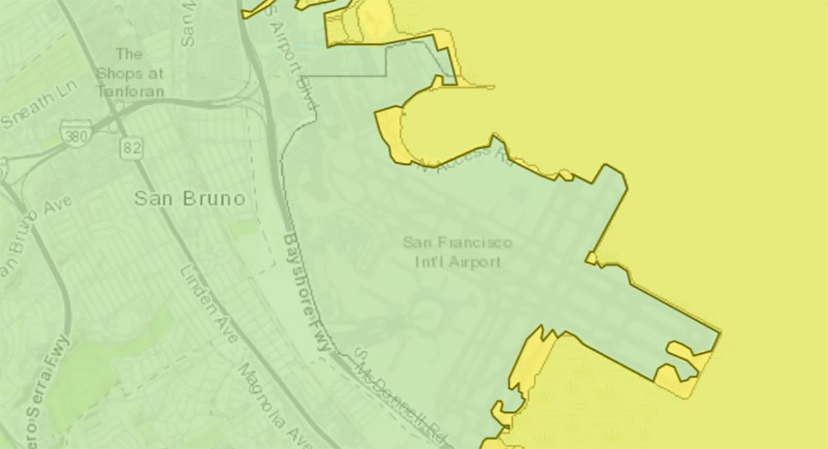
Portions of the Marina, Fisherman's Wharf, China Basin, Oracle Park, Mission Bay, and Bayview Hunters' Point would all also see tsunami impacts in worst-case scenarios. But, interestingly, impacts at SFO aren't predicted to be as bad as one might expect.
As Rick Wilson, a senior engineering geologist at the California Geological Survey tells the Chronicle, a tsunami event of the magnitude being anticipated here would be exceedingly rare, and would take about five hours to reach the Bay Area. "But," he said, "it’s good to prepare for the worst and hope for the best."
See the interactive map below for more.