With the Bay Area now firmly in summer's grip — and still very much held hostage by the pandemic, as well — taking some time to go on a walk on the wild side is one of the safest, least risky activities one can partake in currently.
And it’s an outdoor activity you can do no matter where you're situated in our slice of Northern California. So, here are 21 hikes you can take to comulgar with Mother Nature in the Bay Area — face coverings and social distancing in tow.
San Francisco

Mount Sutro Hill Open Space Reserve Historic Trail
So quiet, so still (and so dense with trees), a hike through Mount Sutro Hill Open Space Reserve Historic Trial is best done without time limits or expectations. It’s all too easy to get lost, figuratively speaking, in the sweeping greenery, vocal birdlife, and expansive viewsheds that wrap the 61-acre green space. Though, take note: the trail is quite narrow and parts are lined with loose gravel. But given the pathway's slightly secretive existence, fellow hikers are few and far between. Move onto Nike Road to find some open spaces to let the dog run about… or to snap a still of the treeline. (Near sunset, it’s particularly haunting when fog envelopes the high-reaching branches.)
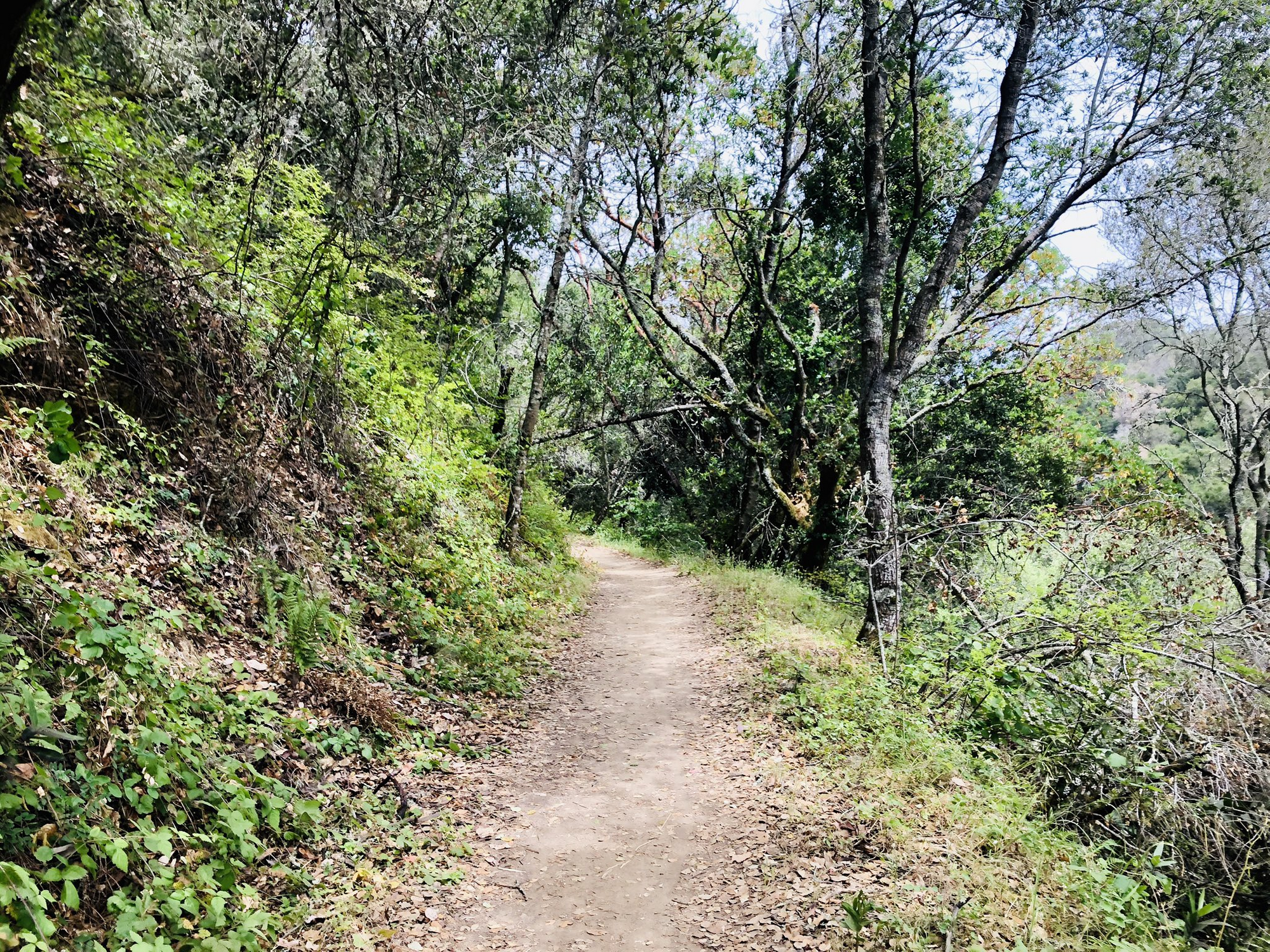
Tank hill stays true to its name; it’s an absolute unit to hike. With unforgiving inclines and blurred trails, it’s a small urban park that’s perfect to take a swift walk on. The north-facing views of San Francisco, are truly a sight to behold — especially around Golden Hour. But don’t feel emboldened enough to leave the kind of marked pathways. The cliff-side rocks here are as stable as our President’s genius and thorny weeds carpet much of the ground.
A 1.7-mile trek that snakes through Glen Canyon Park, the unnamed hiking trail that encircles the parks isn’t only dog-friendly but puts you smack dab in sight of Bay Tree groves and a host of native fauna: coyotes, hawks, garter snakes, and lizards. (If you are planning on taking the fur-child, make sure he or she stays on a leash at all times; coyote sightings around the park are common — and increasing.) Melodic bird songs bounce off rock faces and help muffle the busy city soundtrack. Because of its sheer vastness and subjectively wide passages, a stroll around and through the Glen Canyon Park is a welcomed bit of escapism for those who choose to visit.
Wide enough to drive an F-150 trailering a horse trailer along, the generous hiking paths at Heron’s Head Park offer ample size to properly socially distance. Parking is easy to come by either inside the connecting parking lot or at shouldering nearby roads. And because the main hiking trail is almost flush with the shoreline, this is a very durable, very novice (and quite easy) stroll to undertake — no matter your skill level. If you’re keen on expanding your soiree with Mother Nature, you can venture onto an unmarked, forking narrow walkway that’ll afford you more views of India Basin.
Known for its panoramas of San Francisco and open grasslands, you’ll be able to spot an encroaching, likely masked individual ten yards away before they’re six feet from presence. Both a beloved rope swing and community garden — which, depending on the season, may or may not be populated with blooming flowers and maturing herbs — sit within the park’s confines. The trail, itself, is a one-mile winding pathway, perfect for a half-hour escape into the outdoors. Wildflowers are common around late-summertime, though it’s best to practice the Leave No Trace principles; hold back on plucking those pastel petals.
Noe Peak and Eureka Peak make up the spectacularly scenic, dizzying 31-acre hiking area that, though popular among locals and transients alike, has abundant open space to keep your personal bubble unpopped — all while meandering around its tall crests. Thin, sandy soil mounding Twin Peaks is susceptible to erosion, so best to say on any and all marked paths as to not speed its losing war with Newton’s Third Law. The downtown-facing side of Twin Peaks Boulevard is reserved for bikes and pedestrians, and a walk to Christmas Tree Point will yield a scene frequently used in stock photographs of the 925-foot tall apex.
By no means a secretive passageway, Battery to Bluffs Trail, nevertheless, provides plenty of space to hike — and to not find yourself inadvertently inundating someone's personal space. The two trailheads at Lincoln Boulevard offer a perched view of the Pacific, with the Golden Gate Bridge and Marin Headlands to the northwest; the dramatic bluffs tumbling to the rocky shore below. Also, remember: no dogs are allowed on the trail, so leave the fur-baby at home.
It's an easy, breezy, beautiful (socially distant) stroll traveling along Fort Funston. Despite the fog that usually blankets the otherwise endless view of the Pacific to the west, this slab a green — featuring 200-foot-high bluffs and horseback trails — serves more than enough scenic escapism to be enjoyed for the masses. And unlike Batteries to Bluffs Trail, you can take your pup here, as well as let them off the leash; park in the lot off Skyline Boulevard for easiest access to the trailheads.
Shouldering the much-larger John McLaren park,, this quaint hub of beautiful blossoms and utilitarian vegetables is ringed with spacious walking trails, perfect for a quick escape from your bedroom's maddening confines. The paths around La Grande Community Garden, too, are fairly level and don't ebb and flow in elevation, making them easy to tackle. Nextdoor Crocker Amazon Playground offers great socially distanced green spaces to either indulge in a picnic or to get your heartbeat racing with some in-place workouts.
You don't need to take the Crosstown Trail in its 17-mile entirely to experience its scenic glory, and sometimes testing hill climbs (and situational urban frustrations.) A good chunk of that same breathtaking landscape can be had in the first three miles walking the Start of Crosstown Trail — where you'll have no problem socially distancing. Parking is easy and abundant near Hunters Point Expressway. But, beware: If you park inside the Candlestick Point Recreation Area's parking lot, make sure you get back around 7 p.m., or the gates will trape your automobile on the other side of it.
The aptly named walkway through John McLaren's Park is noted for helping squeeze-out those contemplative juices. A bit under three miles long, the quite flat hike circles the latter mentioned park, putting hikers and runners in the way of wildflowers and wildlife, as well as sinking them into a level stillness rare in this seven-by-seven mile slice of NorCal.
The Yosemite Slough Wetland is nestled in the Candlestick Point State Recreation Area and, more or less, not well known amongst hikers. (Read: the trailheads and pathways are usually empty, no matter the time of day you choose to go explore it.) The estuary is also a prime spot for bird watching — great egrets, double-crested cormorants, brown pelicans! — smackdab on the Pacific Flyway and also offers some nice, quiet respite from the otherwise loud car traffic nearby. As tempting as it may be, opt to stick to the marked trails; the Yosemite Slough Wetland is in restoration; many of the shore areas and green spaces are still recovering from erroneous human intrusion.
Sure: it's shouldering sister apexes, Twin Peaks, get a lot of hype — but the smaller, less-trafficked Kite Hill is a hiking touchstone that shouldn't go unturned. Less than a mile long, it's a no-brainer quick jot to take if you're in the area. The Douglas stairs are latticed with vines, and there's always some sort of avian or mammalian neighbor sitting (or perching) somewhere on the trail, too; orange and purple wildflowers are bountiful even toward the tail end of July. Stop along the way at the Corwin Street Community Gardens before ascending to the peak to see 360-degree views of the city.
Edgehill Mountain Open Space Park Trail
This open space is an albatross to most San Franciscans, mostly in part because it exists between both Twin Peaks and Mt. Davidson — and is often overlooked, figuratively speaking. (If you're at the top of those previously mentioned summits, you'll for sure see Edgehill Mountain.) The trail to its summit is a simple out-and-back trek that won't take more than 35 minutes if you're going at a reasonable click. Take a pause at the top to appreciate the view of the Pacific to the west.
East Bay
Piedmont Park's Prospect-Mountain Trail
Without needing to drive a good way from downtown, Oaklandians can find some urban respite at the surprisingly quiet Piedmont Park. The Prospect-Mountain Trail, a wide walking and hiking passage that crosses the area, leads you to a few picnic spots and open spaces where you can plop down, read a book, or... just do nothing at but relax. And to hit two metaphorical birds with one stone, pick up produce at the nearby farmer's market, Green Market, which is held every Saturday behind the Park Tavern parking lot.
Martin Luther King Jr. Regional Shoreline
Part of the East Bay Regional Parks system, the park covers 741 acres of land leased from the Oakland Airport that features a bevy of accessible green spaces and gorgeous, shore-hugging trails. Bird watching is phenomenal here; the areas near the Arrowhead Marsh are frequented by birds traveling on the Pacific Flyway. All the hiking trails are both wide and level, and you can sunbathe at Doolittle Beach off Hegenberger Road.
Claremont Canyon Regional Preserve
The 208-acre preserve — nestled right between Oakland and Berkely — is snaked with hiking and equestrian trails that serve up glorious panoramas of Bay Area cities. The Stonewall-Panoramic Trail is a 0.75-mile climb, offering the main access to the preserve via from Stonewall Road to the ridgetop is steep and, as the name suggests, gives hikers a grand view of the SF Bay. Similarly, the nearby Gwin Canyon Trail, located south of Claremont Avenue, sits on the descent from the north end of Norfolk Road; expect to come shoe-first to a myriad of native vegetation and wildlife.
Shouldering the Oakland Zoo — which, alas, has finally reopened to sold-out crowds — the Anthony Chabot Regional Park includes not only some of the Bay Area's best local campgrounds but phenomenal hiking as well. For an all-in-one experience that spans the gamut, take the park's 8-plus-mile Redtail Trail Loop which puts walkers in the way of grasslands, chaparral, and groves of towering eucalyptus; hikers will also bud up against Lake Chabort's northern shorelines. To just take advantage of the viewshed atop the San Leandro Hills, traverse the part of the trail that sits between the intersection of Redwood and Marciel roads, and Public Gun Range and Mariciel roads.
McLaughlin Eastshore State Seashore
This shoreline refuge is crossed by a small chunk of the San Francisco Bay Trail that also includes swaths of grass to revel in some socially distant picnicking atop of or do other recreational merriments at — conducted six-feet-away from another human, of course. The tidelands ing the area include tidal marshes and mudflats that extend from the shoreline; a lot of the existing upland area is the result of "fill placement" in the Bay west of the historic shoreline. The shoreline's wide hiking trails offer a glimpse into the Bay Area's unique, often cumbersome, relationship with both natural systems and human interventions to help preserve it (and erase our prior environmental mistakes).
North Bay

Though the Marin Headlands are notorious for being popular with the outdoor ilk, the SCA Trail north of Kirby Cove is a welcoming, less-trafficked pathway through the area. The trail cuts into the side of the mountain and faces westward, giving you picturesque views of the all-consuming greenery. To take the two-mile(ish) back-and-out trail a bit further, veer onto the Coastal Trail — a hike that'll also put you within walking distance of Slack Hill — to extend it out another mile or so each way.
A 4.1-mile loop trail with a moderate degree of difficulty (read: you'll ebb and flow in elevation quite a bit), the Green Gulch Trail offers great views of the ocean and groves of tree life. It's not only well maintained year-round, but hikers can choose to go through the organic community farm to start their journey, should they choose to pull the e-brake at the Muir Beach Parking lot. People have noted that fellow hikers are respectful of social distancing and almost everyone had a mask, too boot. And though the Green Gulch Farm, the shouldering Buddhist practice center that the trail itself is named after, consider viewing one of their free Sunday live streams on a nearby patch of green to find some needed zen amidst a very uncentering time in human history.
Related: The 11 Best Hikes: East & North Bay Edition
New Bay Trail Expansion Offers Glorious SF Bay Views and Connects Oakland to Richmond
Image: Taken at an overlook at Tank Hill, courtesy of SFist/ Matt Charnock