You've likely heard it said that we won't be out of this historic drought without several winters like the one we've had thus far. And the latest map from the U.S. Drought Monitor shows us where we're at.
"Over the past few weeks, a series of atmospheric rivers brought significant amounts of rain and snow across parts of the West leading to improvements in soil moisture, streamflow, reservoirs levels and snowpack," says the U.S. Drought Monitor in its latest update. "Despite these improvements, long-term drought persists across much of the West."
Still, after the most recent round of rain, the monitor notes, "In California, improvements were made based on multiple weeks of above normal precipitation and improving reservoirs, streamflow and indicators."
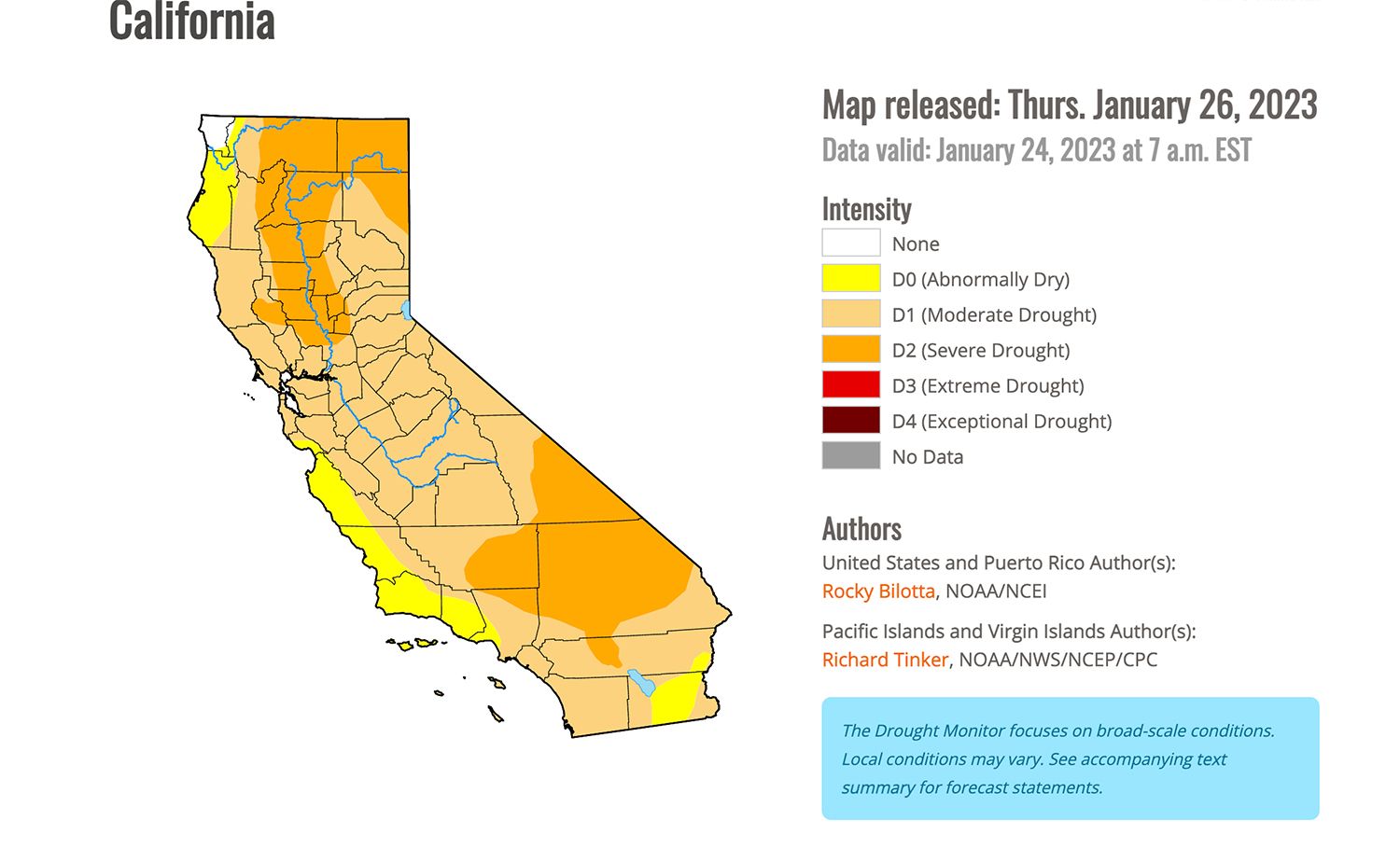
As you can see, a couple spots in far-northern and far-southeastern California, along with the Central Coast all the way to Los Angeles, are now out of the drought and are merely back in "Abnormally Dry" status — with only the far northwest corner of the state experiencing no dryness, indicated in white.
The majority of California remains in D1 status for "Moderate Drought," with large swaths of inland Northern California and the Southern California deserts still in D2 or "Severe Drought." No part of the state remains in "Extreme" or "Exceptional" drought status as of now.
But look at the comparison from early September:

And looking back two years, to a very different January in 2021...
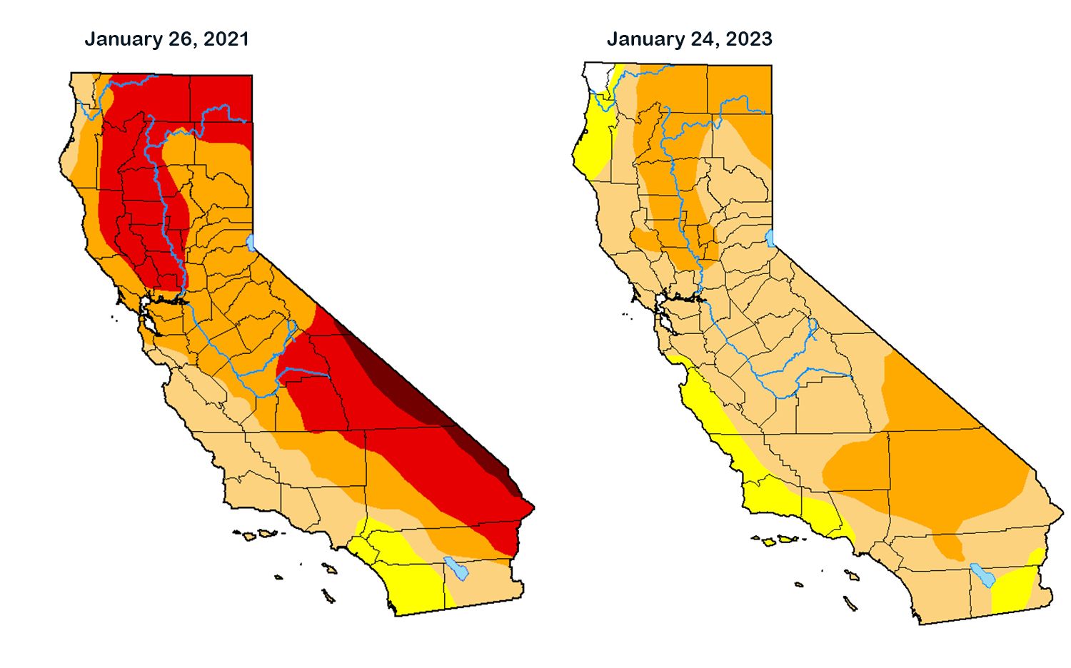
There's no question things are improving, and we've got another two months of winter left, but as the Chronicle's meteorologist Gerry Diaz noted this week, the current dry pattern, in which a high-pressure bubble is pushing all the Pacific moisture to the far Pacific Northwest and Alaska, is the more typical pattern for a La Nina winter like we're supposed to be having.
Previously: The Current Western U.S. Drought is the Worst in 1,200 Years, Says New Study