The storm bringing with it heavy rain, high winds, and thunderstorm cells can be seen as a distinct cyclone off the coast of Oregon and Northern California — and it's not through with us yet.
The National Weather Service's Bay Area bureau has spent the morning issuing Special Weather Statements about wind, hail, and thunderstorm activity all over the Bay. San Francisco residents were likely awoken by the loud sound of hail falling and a deluge of rain as a cell passed directly over the city at 6:15 a.m. Tuesday. And more cells could be passing through between now and 2 p.m., as ABC 7 meteorologist Drew Tuma warns.
Blinding rain and hail right now in San Francisco pic.twitter.com/xcog2zW9Ek
— Drew Tuma (@DrewTumaABC7) January 10, 2023
We are under the threat of more thunderstorms until 2pm this afternoon. Satellite and radar showing more storms developing off of our coast with numerous lightning strikes and they are heading our way. pic.twitter.com/5BcuQHK5tb
— Drew Tuma (@DrewTumaABC7) January 10, 2023
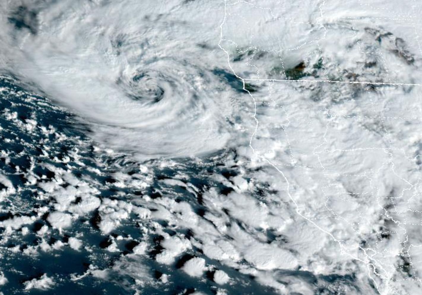
The satellite images below are from 9:50 a.m., and they show the pinwheeling storm off the NorCal coast, and the swirling bands of moisture around it that extend all the way to the Mexican border. This is our latest atmospheric river event, fueled by a strong jet stream.

How this is translating into rain and snow can be seen in the radar image below. See it in motion at Accuweather.

We will be seeing intermittent showers — and possibly more thunder and hail — through about 2 or 3 p.m., after which we'll get a brief respite and our skies will clear up a bit.
Showers may pick back up again by 6 p.m. and for a few hours after that, with clear overnight hours until around 4 a.m. Wednesday, when more rain moves in.
A wet early Wednesday will lead into a mostly dry and cloudy Thursday, with Friday and Saturday promising to be even wetter still. It remains to be seen whether we will get anything as intense as this morning's super-heavy downpours, however.