It doesn't seem as though the term "atmospheric river" has been in common use for more than a decade or so by TV weather people. But lately it comes up pretty much every winter to describe a strong band of moisture of series of them, like the storms that are descending on the Bay Area today.
The term only originated in the 1990s, coined by MIT researchers Reginald Newell and Yong Zhu of the Massachusetts Institute of Technology, and it describes the "rivers" of moisture that travel in distinct bands, often forming over the Pacific around the tropics in northern hemisphere winter. The term "Pineapple Express" is a bit older, dating to the 80s and describing the same phenomenon — storms that travel from around Hawaii and batter the California coast. As the book Weather of the San Francisco Bay Region by Harold Gilliam (UC Berkeley Press) explains, before that term became popular, these were just called "Hawaiian storms."
An atmospheric river is a column of condensed moisture, often a thousand miles long and dozens or hundreds of miles wide, that is able to deliver heavy rain and snow in a short amount of time. Other terms used to describe the same thing are "tropical plume" and "water vapor surge." But as KQED explains, the river analogy is a good one because one such storm system is capable of delivering about 27 times the amount of moisture as what flows through the mouth of the Mississippi River in a day, all in one long band.
For the Western U.S., ARs, as meteorologists call them, are hugely responsible for annual water supplies as well as catastrophic floods.

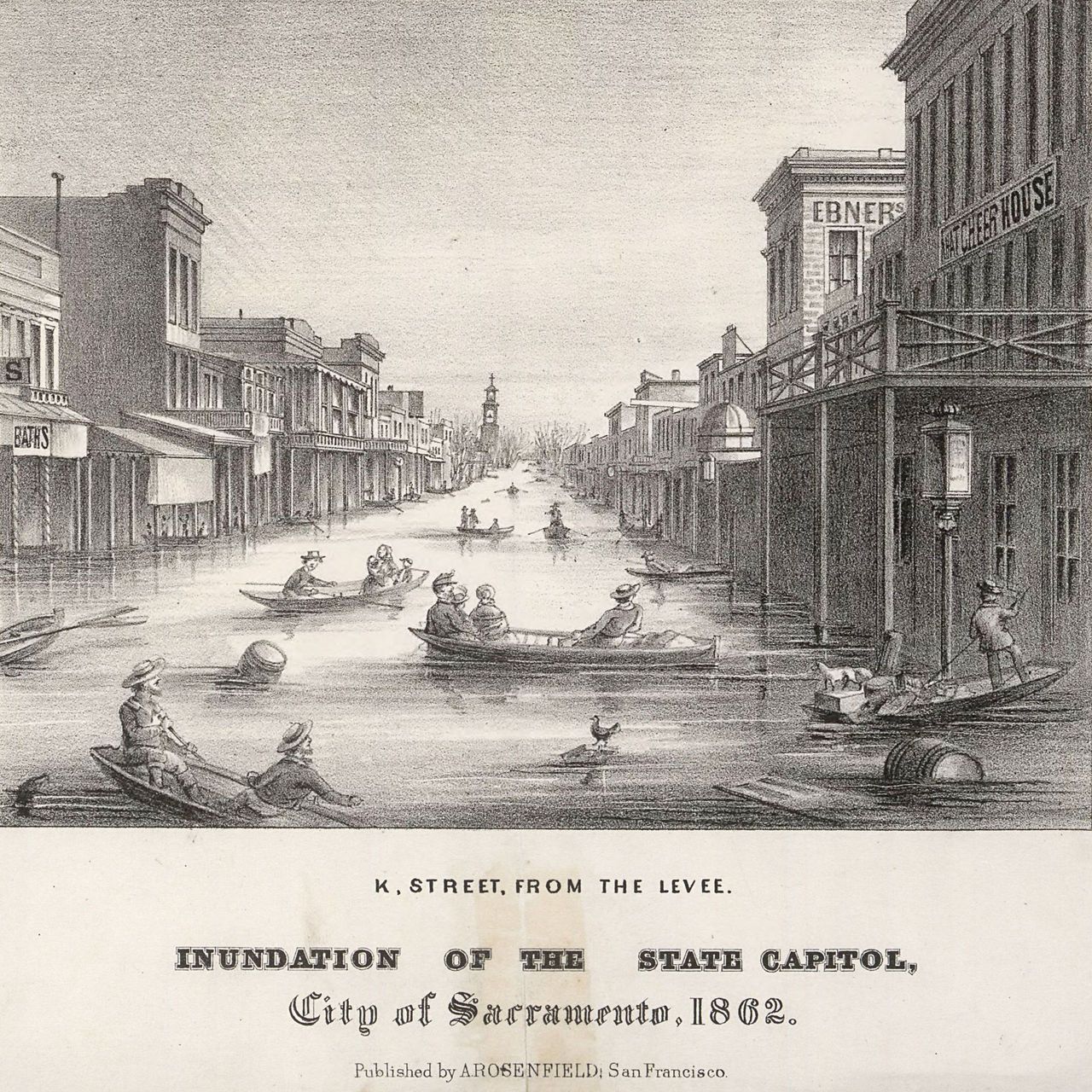
An extraordinary December-January atmospheric river that brought 45 straight days of rain to California is responsible for the Great Flood of 1862 that famously turned Sacramento's roads into canals.
And atmospheric rivers have been responsible for major "rainpocalypses" in the Bay Area in recent years (like in December 2014, and December 2016).
As of 2019, meteorologists now rank atmospheric rivers on a 1-to-5 scale, like hurricanes, with AR1 being the weakest — and the one hitting the Bay Area starting today and intensifying through Thursday is still being called an AR1 for much of the region, though it may be an AR2 to our south.
But looking at the satellite images, it sure looks hurricane-esque!
Here comes our storm! This #GOES17 satellite loop with lightning flashes confirms the strength of this system approaching the NW CA coast & the long stream of moisture associated with it. We expect rain to pick up along our Central Coast tonight. #CAwx #AtmosphericRiver #LArain pic.twitter.com/WZjUE169sA
— NWS Los Angeles (@NWSLosAngeles) January 26, 2021
Rain is expected to begin falling first this afternoon in the North Bay, with San Francisco and points south seeing rain getting heavier by nightfall. Winds will be kicking up tonight as well, with high-wind advisories in effect.
There is even some lightning being detected in the storm, indicating its strength, as the National Weather Service says.
In the Sierra, a blizzard warning is in effect through Friday, with many feet of snow likely to fall at higher elevations — and everyone is being told to hunker down and not travel.
⚠️ Blizzard Warning for the Sierra ⚠️10 PM tonight thru Friday. Strong winds will produce zero visibility & whiteout conditions with high drifting snow. This will be a dangerous & life-threatening situation. Do not attempt to travel.
— NWS Reno (@NWSReno) January 26, 2021
Winter Storm Info - https://t.co/CRkNyVZRtH pic.twitter.com/F9Xy8omvTo
Here's another look at the incredible snowfall forecast in the Sierra Nevada over the coming days. Snow totals may reach *10 feet* across the highest elevations #CAwx pic.twitter.com/0VbfeE8r05
— Evan Fisher (@EFisherWX) January 26, 2021
Stay safe and dry, everybody!