You've likely seen the news reports and heard all the alphanumeric names being thrown around (LNU, CZU, 15-10, Hennessey, Gamble), and yes, it feels like we're in yet another apocalypse. But just to get a handle on this: These fires are fairly spread out, some are worse/more threatening than others, and around 50 homes have been confirmed destroyed so far (that number may already be out-of-date), though thousands are threatened as winds are expected to pick up Wednesday evening.
In our morning update on the fires, we discussed the various combinations of smaller fires that have been made by CalFire under "complex" names, which is going to continue to make this confusing. In addition, there are still smaller fires and many of the original fire names are being used even though their perimeters may begin overlapping.
Below, a few maps for clarification (also see the updated 8/20 maps here):
North Bay
LNU Lightning Complex fires - Napa, Sonoma, and Solano counties

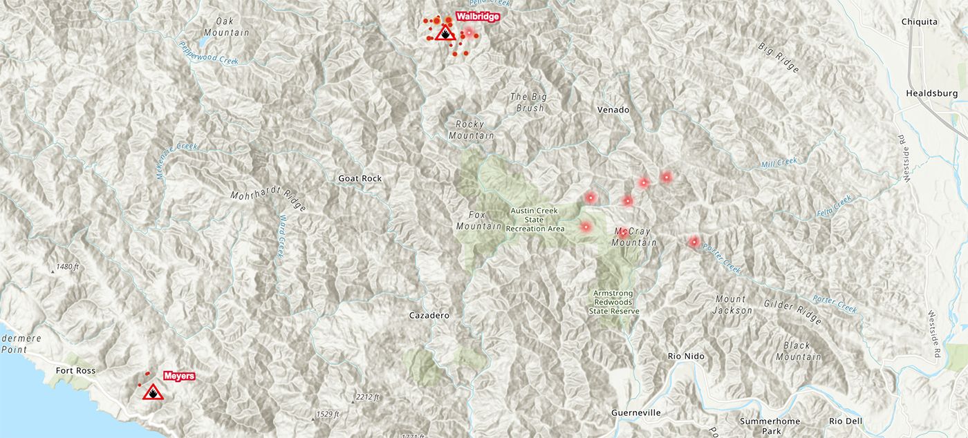
CalFire is now combining the Walbridge and Meyers fires in western Sonoma county with the group of larger fires that began the same day, Monday, in eastern Napa County. The combined footprint of the blazes is around 46,000 acres as Wednesday, however some of the footprints are far apart. It is currently 0% contained and burning in multiple directions, including threatening Vacaville. The fires have reportedly destroyed around 50 homes, and last night burned a mobile home park in the community of Spanish Flat on Lake Berryessa.
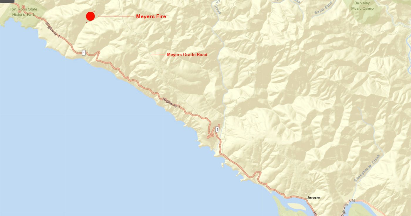
Below is an inset of the approximately 25-acre Meyers Fire near the coast, northwest of Jenner.
The map below shows how hot spots have appeared south of the Walbridge fire close to the old-growth redwood grove in Armstrong Woods, near Guerneville.
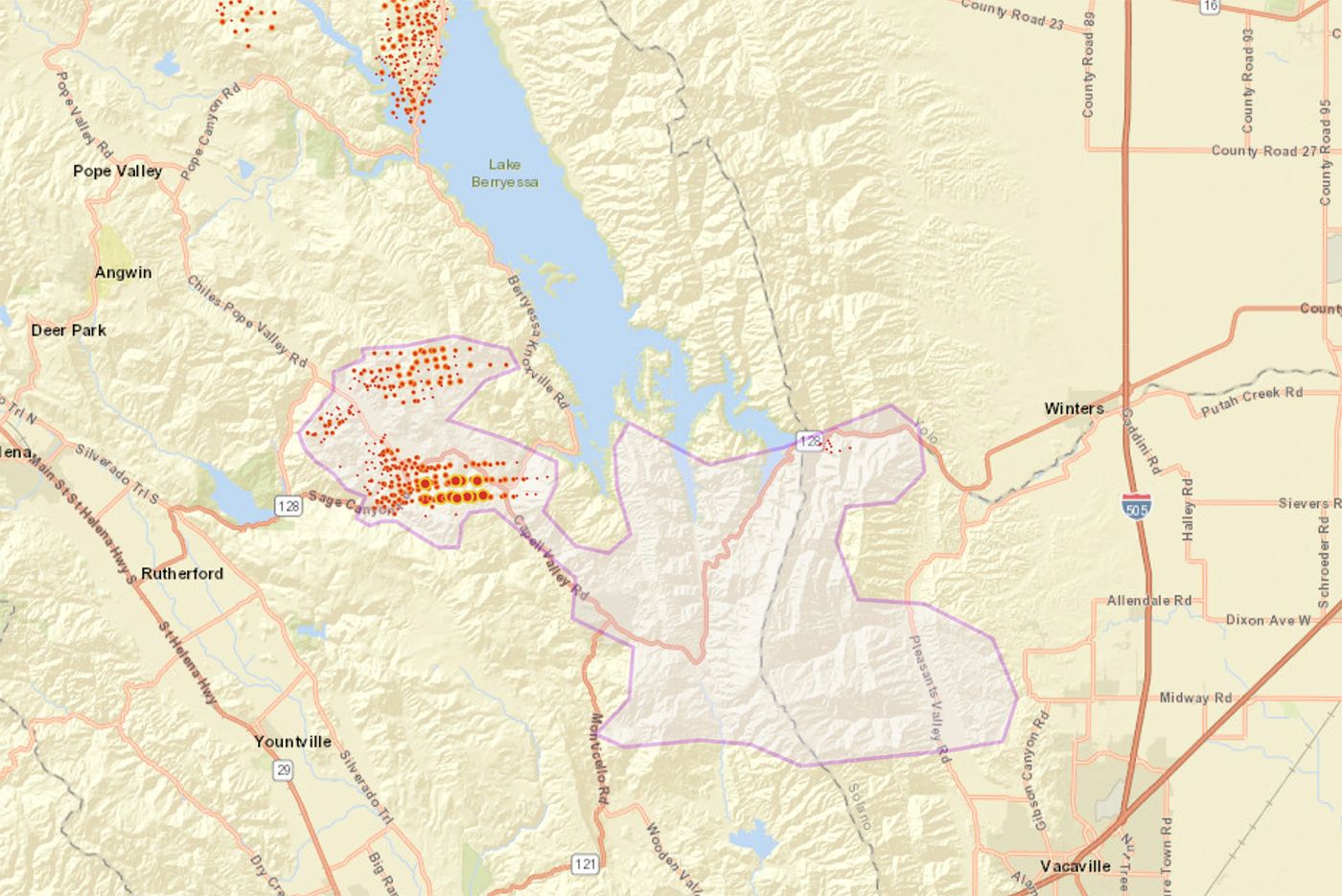
And below, shaded in purple, you can see where firefighters believe the LNU Complex could spread to the south and east into Winters and Vacaville in the next day or two, and the map below that indicates where spot fires have already appeared in Vacaville.

Update: See the updated maps as of August 20 here.
Woodward Fire — Marin County
A visual of the North End of the #WoodwardFire taken about an hour ago from @MarinSheriff UAV. The UAV is being used to assist with the mapping and fire strategy for operations.
— Marin County Fire (@marincountyfire) August 19, 2020
** No aircraft assigned to the fire, which is why the UAV was utilized. ** pic.twitter.com/M3hPnVaZqh
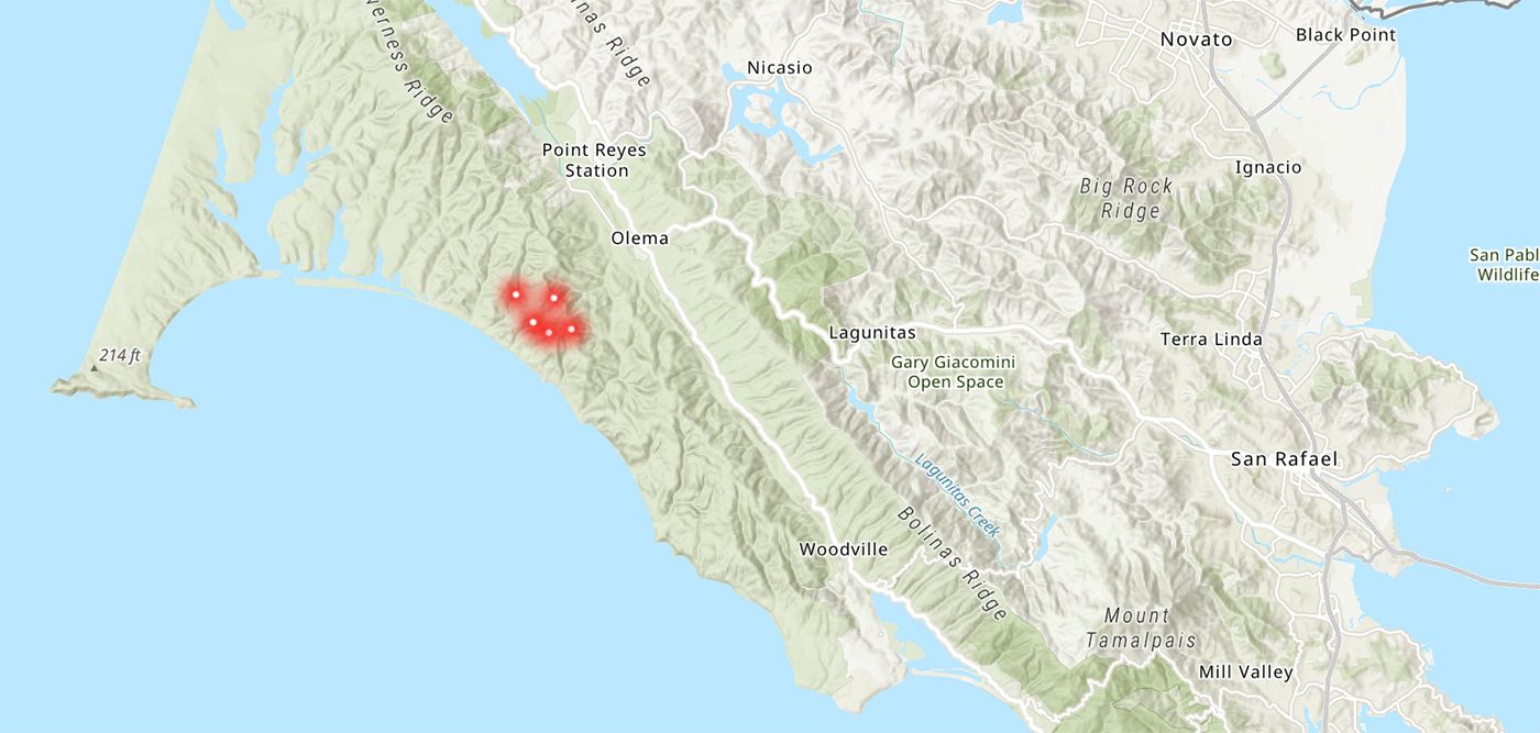
What began as a small 7-acre fire on Tuesday west of Olema near the coast in Point Reyes has grown to 1,100 acres, as KPIX reports, and much of the Point Reyes Peninsula is under an evacuation warning.
Peninsula and Santa Cruz
CZU Complex Fires - San Mateo and Santa Cruz Counties
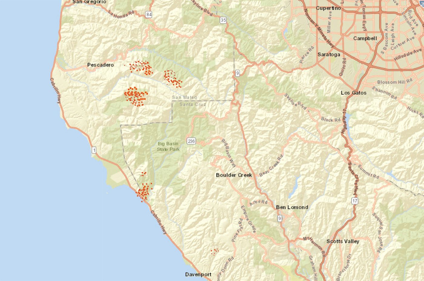
What's being called the CZU Lightning Complex includes the 5-14 Fire east of Pescadero in San Mateo County — at Olmo Truck Trail and Butano Fire Road, which stands at about 3,000 acres and 0% containment; the Warrenella Fire near Cement Plant Road and Highway 1 in Santa Cruz County, which stands at 120 acres, and 5% containment; and the Waddell Fire near Old Coast Road Highway in Santa Cruz County which stood at 500 acres and 0% containment. Also there are the 5-15 and 5-18 fires which are about 3,000 acres apiece.
In total, CalFire is saying the CZU Complex has burned 10,000 acres as of Wednesday afternoon. See the full list of evacuation orders and road closures here.
East Bay and Beyond
SCU Lightning Complex — Contra Costa, Alameda, Santa Clara, Stanislaus, and San Joaquin counties
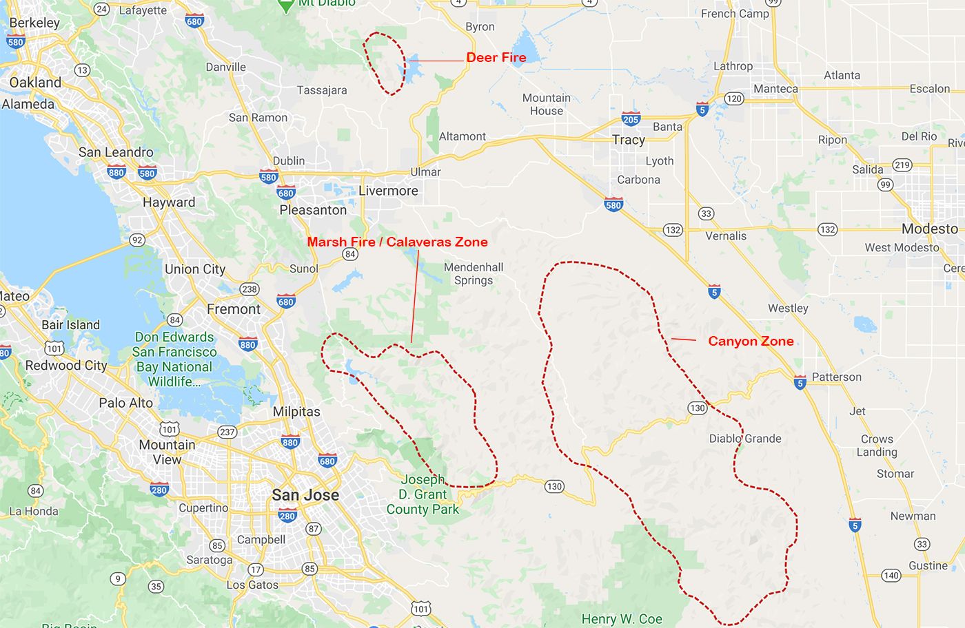

The CSU Lightning Complex fires include a fire east of Mount Diablo originally called the Deer Fire — now the "Deer Zone" of the complex — the Marsh Fire northeast of Milpitas — now part of the "Calaveras Zone" of the fire — and a mass of fire straddling three counties to the east of that now called the "Canyon Zone." This is the largest complex of fires currently burning, with 85,000 acres already burned, but remarkably, per CalFire, no structure damage has been reported so far. Two firefighters have been injured fighting the blazes.
This complex stands at 5% contained.
Top image of the Hennessey Fire on Tuesday night by Justin Sullivan/Getty Images