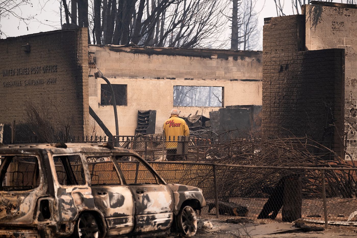
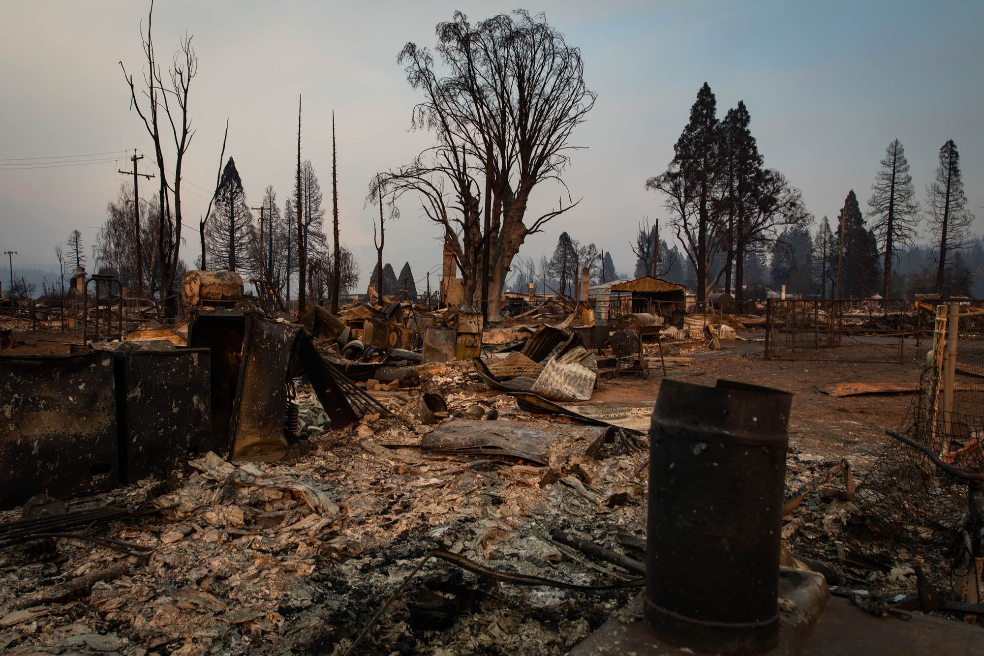
New satellite images and on-the-ground photos from Greenville, the Northern California town of about 1,000 people that was leveled by the flames of the Dixie Fire last week, paint a sad but increasingly familiar picture of a wildfire's wrath.
Greenville was a Gold Rush town, nestled in Gold Country in Plumas County, and it still had a Main Street that evoked the mid-19th Century with its clapboard-sided storefronts.
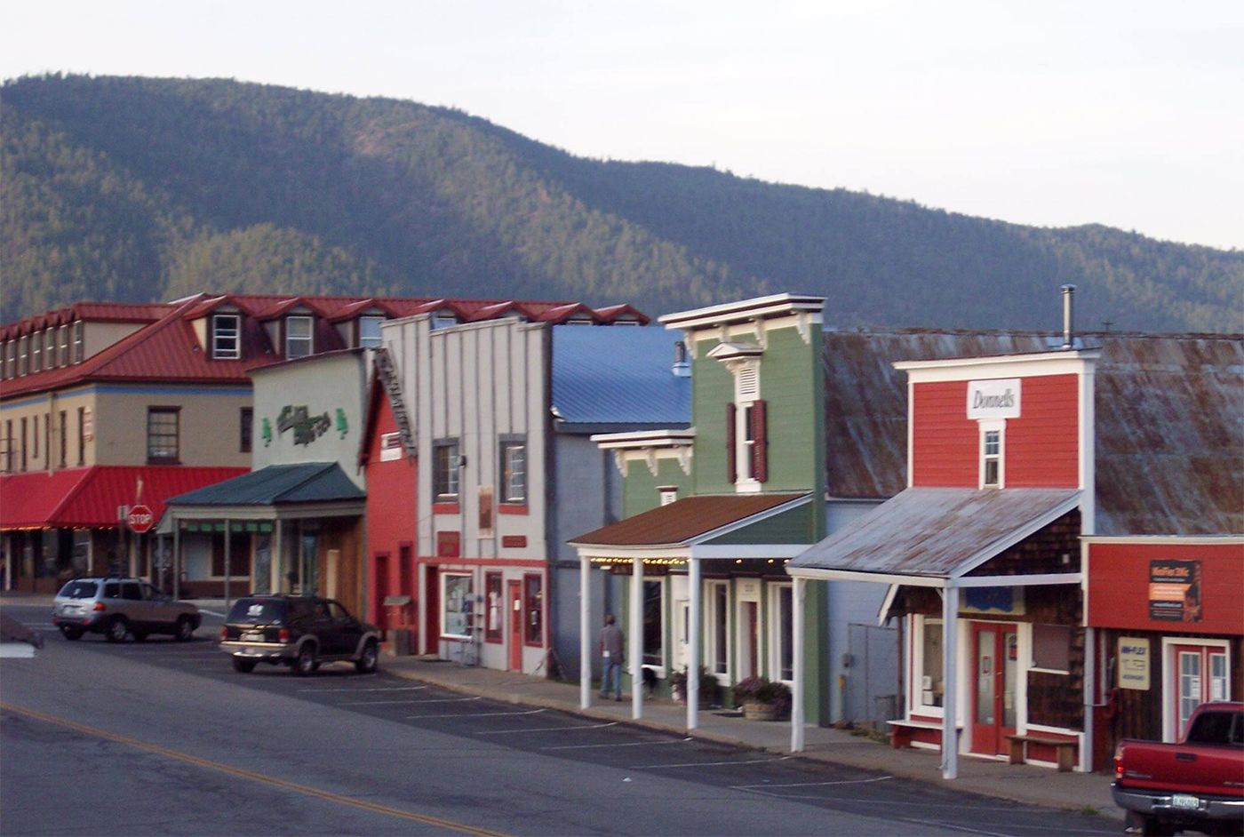
This image was taken on Main Street on Monday:

The Dixie Fire has so far destroyed over 1,000 buildings, including around 550 homes, many of them in this one town.
Satellite images released this week show before-and-after looks at Greenville from above.
New before-and-after imagery shows just how extensive the destruction in Greenville, California, is after the Dixie Fire swept through the town last week. https://t.co/UP9nS0Mzfq pic.twitter.com/f7nvTwKHRP
— CNN (@CNN) August 10, 2021
Reuters has more of those satellite images here.
More before-and-afters:
Juxtaposed images captured before and after the Dixie Fire tore through Greenville show the fire’s devastating effects on the town of about 2,100 people
— San Francisco Chronicle (@sfchronicle) August 5, 2021
Story: https://t.co/YKg8GBzZc8 pic.twitter.com/gVmUcNYOPv
Unlike the Camp Fire in 2018, the Dixie Fire has not moved quickly enough to claim any lives. But much like Paradise was leveled in that fire, Greenville will face a long and tough road to rebuild — and the loss of California history is being deeply felt there as well, with buildings gone that were over a century old.
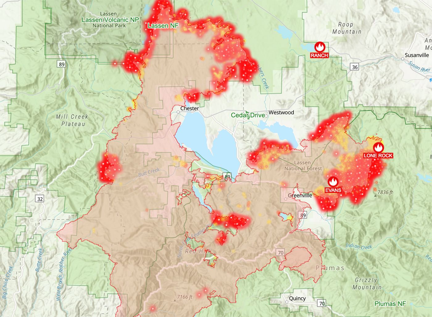
The Dixie Fire continues burning and is the largest single wildfire in recorded state history, at over 500,000 acres. As of Wednesday morning, it was 30% contained, but it was still actively burning in Plumas National Forest and Lassen National Forest, and in the woods outside Westwood, population 1,600. That town is currently evacuated and is "surrounded by fire," according to one evacuee.
This map from today shows where the fire is active:
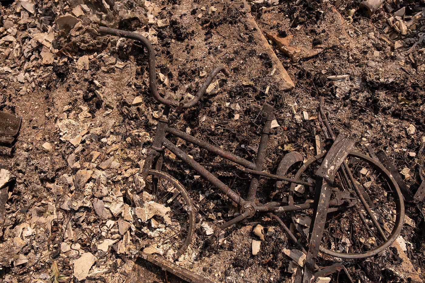
Some more photos via Getty Images: