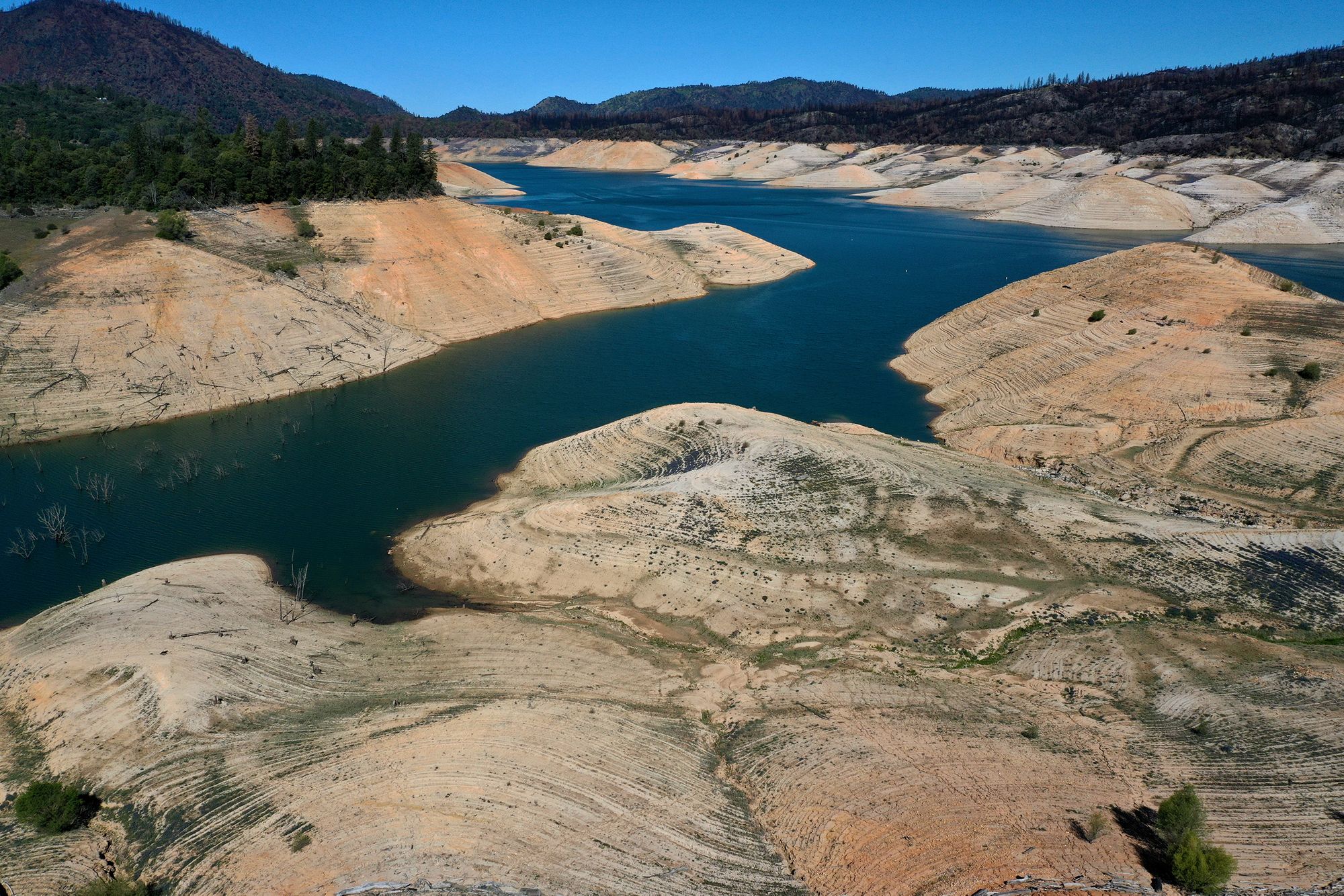
Lake Oroville, California's second-largest reservoir, has been the setting for dramatic images of both the last drought, and the rainy El Nino aftermath of the drought that led to a near disaster at Oroville Dam in 2017. And, once again, with the reservoir at 42% of its capacity, some new photos are rolling in.
Built in the 1960's by Jerry Brown's dad, Gov. Edmund “Pat” Brown, Butte County's Lake Oroville captures water from the Feather River watershed and holds 3.5 million acre-feet of water when full. As a lake, it also serves as a houseboating destination in warm weather, and one of the new photos from Getty photographer Justin Sullivan shows a lot of houseboats crowding onto what's left of the lake earlier this week.

Water from Lake Oroville, which comes from snowmelt in the Sierra, is used as drinking water for 27 million Californians from Silicon Valley to Los Angeles, as the Mercury News reminds us. Thus it becomes the poster child of any drought in the state, with this years beginning to look worse for many counties.
The low water level on the lake is the result of two dry winters in which Sierra snowpack measurements came up to just over half of average on April 1, two years in a row.
According the Mercury News, with reservoirs elsewhere in the state at healthier levels, experts say mandatory water-use restrictions aren't likely for most of California this year. But if next winter is just as disappointingly dry, the mandatory restrictions will likely arrive next spring.


Back in February 2017, in the middle of a very snowy and rainy winter in Northern California, Lake Oroville filled to its full capacity, necessitating the use of its massive spillway at Oroville Dam. The first release of water opened up cracks in the 50-year-old concrete spillway, leading to significant damage that sparked fears that any more release of water could compromise the entire dam. This led to the first-ever use of the dam's emergency spillway, which was essentially just a concrete lip that allowed water to pour down the side of the earthen dam below, threatening more erosion. The crisis spurred a massive evacuation of 188,000 residents downriver from the dam as the threat of a major flood loomed, but thankfully that didn't happen.
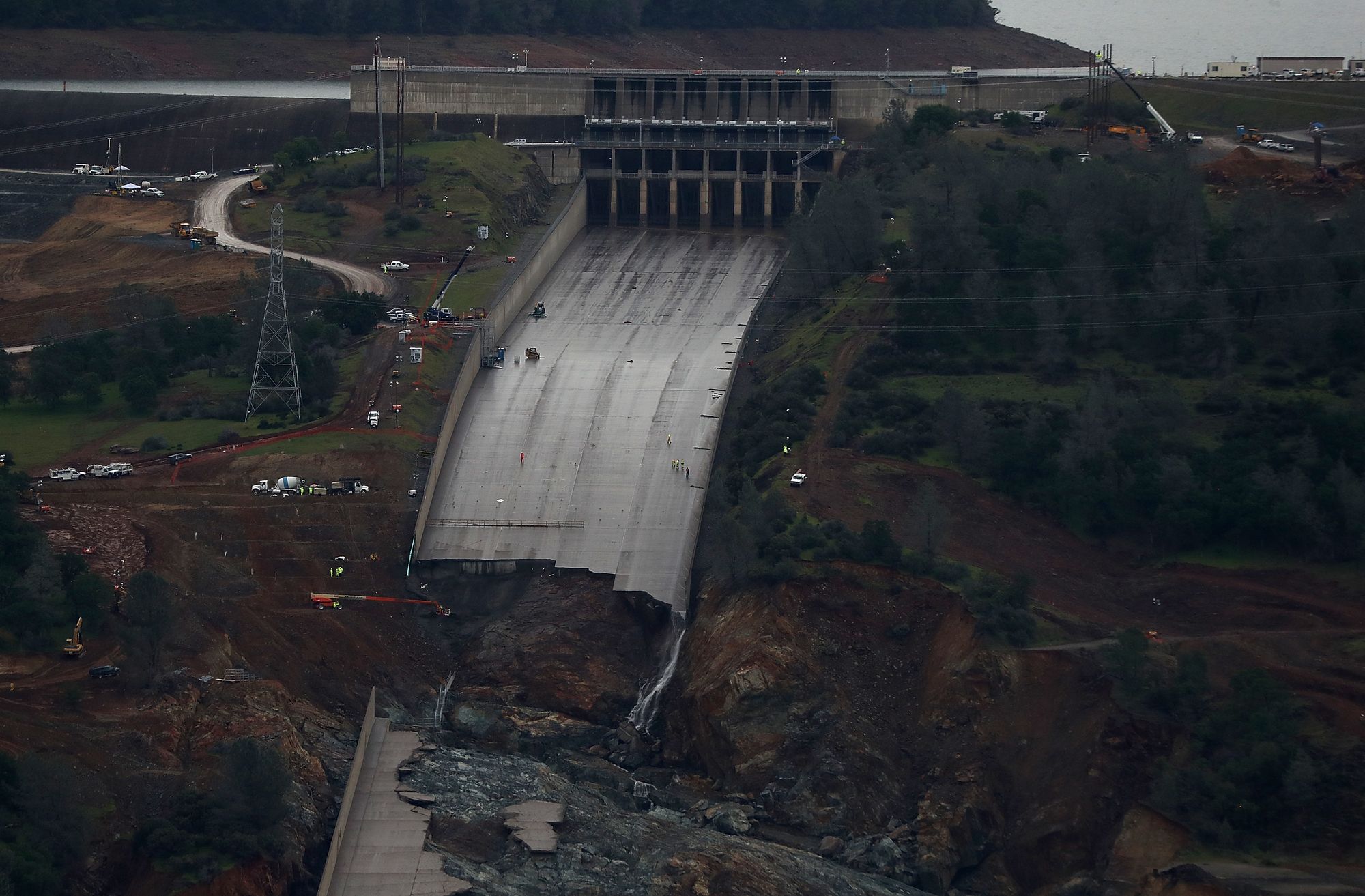
Repairs to the spillways were completed in 2019, and the main spillway is now the width of a 15-lane freeway, with twice the spillage capacity as the old spillway. It was put into use following heavy rains in April 2019.
As the Chronicle reported last year, FEMA reimbursed the state for 75% of the $1.1 billion cost to replace the spillways, about a year after FEMA rejected most of the state's request (under Trump).