
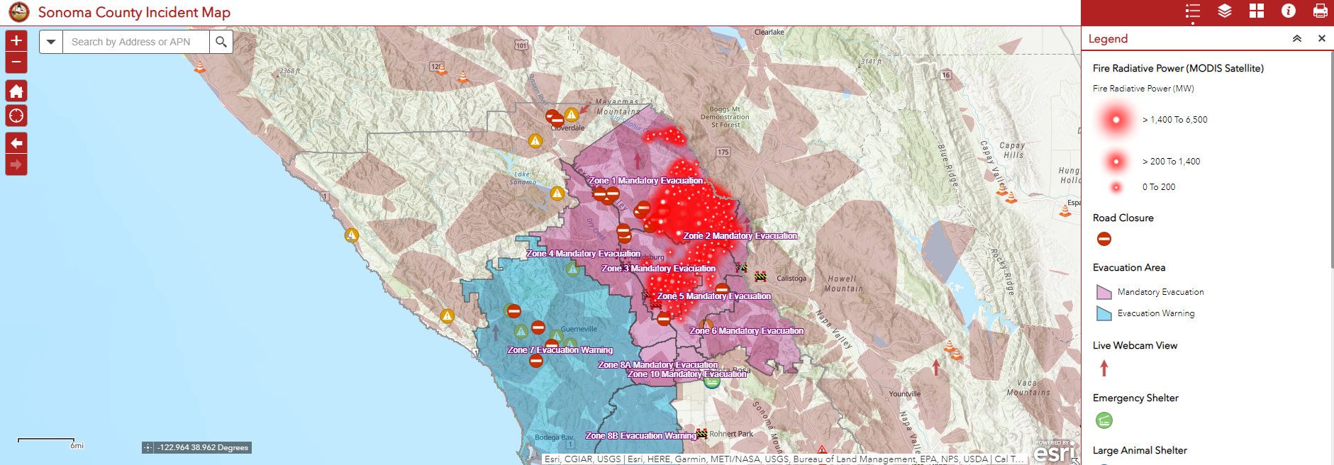
It remains a dynamic situation in northern Sonoma County where the Kincade Fire more than doubled in size Sunday night in terms of acreage burned and burning.
With ongoing power outages and widespread mandatory evacuations, SoCoEmergency.org has brought us an auto-updating fire map which seeks to provide information on the fires throughout Northern California, including updates on the fires in Sonoma & Contra Costa, as well as details on evacuation zones, power outages, road closures, and much more. This Sonoma fire map can also be used to learn about the progress of fires in Southern California and throughout the state.
The purple area is where a mandatory evacuation order is currently in effect. And the size of the red halos around white dots indicates the relative radiative power of that area of the fire. As the Chronicle reports, evacuation orders that were formerly given for the Russian River Valley over to the coast and Bodega Bay have been reduced to evacuation warnings as of Monday.
The Sonoma County Incident Map can lag as much as 12 hours on average, as the data is updated roughly every four to six hours, as indicated by the Sonoma County Emergency website.
For information on changing air quality, which SFist reported on earlier today, we encourage you to visit AirNow.gov.
Previously: Kincade Fire Doubles In Size, Moves Into Tubbs Fire Territory Overnight

Join the conversation
Comments
Comments load automatically as this section approaches.