
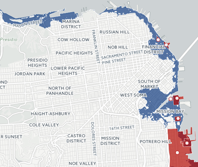
A big new package of stories about sea-level rise from SF Public Press might just scare developers straight, as it comes with this spooky map of future San Francisco and points out 27 proposals for major construction projects that might well be flooded in decades due to climate change.
To create the map, the Public Press partnered with the Cal Berkeley Cartography and Geographic Information System Education Lab. Together, they employed flooding and sea level projections from the US Geological Survey and the San Francisco Public Utilities Commission.
On the map, gray represents bay water up to the current, familiar shoreline, while dark blue "shows a severe storm scenario on top of a high-end projection for sea level rise" totally about 8 feet.
Co-director of the West Oakland Environmental Indicators Project Brian Beveridge told the Public Press, "It's going to fall down along lines of class and political power—who will be protected and who will be thrown to the dogs."

Join the conversation
Comments
Comments load automatically as this section approaches.